Cincinnati, Ohio — Drivers across southwest Ohio are starting the day under a gray and hazardous sky as patchy freezing fog settles over river valleys and major roadways near the Ohio River. Early-morning travel is impacted by reduced visibility and slick pavement, particularly in low-lying areas around Cincinnati.
According to the National Weather Service, temperatures hovered near 29 degrees early this morning, creating conditions where fog can quickly freeze on untreated surfaces. Visibility has dropped to around one mile or less in some spots, with the greatest concern along I-71, I-75, and roads close to the river.
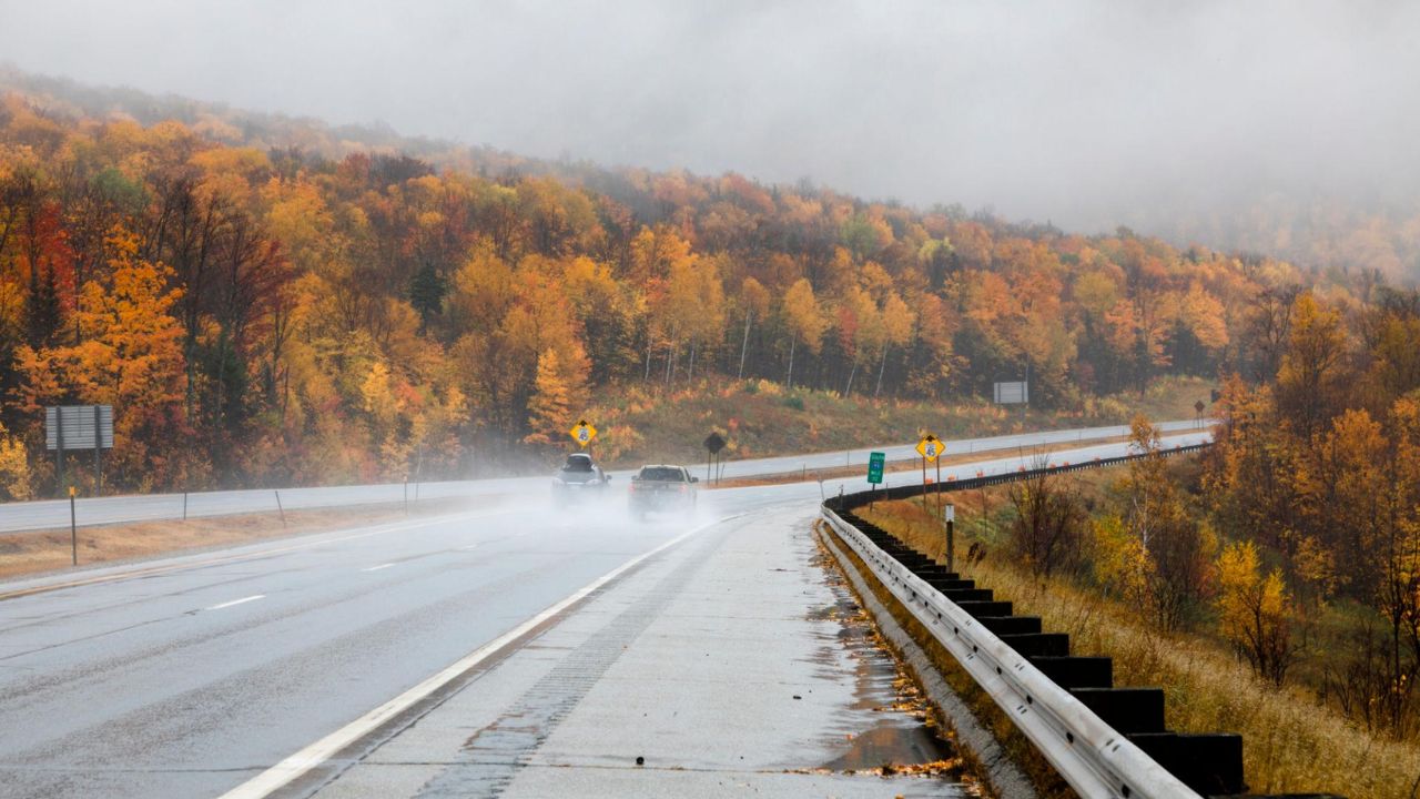
Freezing Fog Creates Early Travel Hazards
Freezing fog is especially dangerous because it can leave behind a thin glaze of ice that is difficult to see. Drivers may encounter slick bridges, overpasses, and shaded stretches of road just before sunrise.
Motorists are urged to:
- Slow down and increase following distance
- Use low-beam headlights in fog
- Watch closely for sudden drops in visibility near rivers and valleys
Even areas that appear clear can become slick quickly, particularly where moisture settles overnight.
Conditions Improve as Temperatures Rise
As the morning progresses, fog gradually lifts and visibility improves. While clouds remain in place, temperatures rise rapidly through the late morning and afternoon, reaching the low 60s around Cincinnati.
The warmer air helps melt any lingering frost or thin ice, though damp roads may persist into the afternoon hours. Caution is still advised, especially on secondary roads and in shaded areas.
Rain and Strong Winds Move in Friday
A more active weather pattern arrives tonight and continues into Friday, bringing increasing chances for rain and strong winds. Showers are expected to develop mainly after daybreak Friday, with temperatures surging into the upper 60s.
As the system moves through, winds strengthen significantly. Forecast models show wind gusts approaching 40 mph, particularly from late morning through Friday afternoon.
These gusty conditions may:
- Shift lightweight outdoor objects
- Make driving difficult for high-profile vehicles
- Cause brief power disruptions in isolated areas
Residents are encouraged to secure loose items ahead of the strongest winds.
Cooler Air Follows the Storm System
Rain tapers off by Friday night, but breezy conditions linger as colder air moves into the region. Overnight temperatures fall into the 40s, setting up a cooler and more stable weather pattern for the weekend.
While snow is not expected locally, the shift in air mass brings noticeably colder conditions.
Weekend Weather Outlook for Cincinnati
Saturday remains mostly cloudy, with periods of rain early before drying later in the day. Highs stay near the mid-50s, then cool further by evening. Damp spots may remain on roads, especially in shaded areas.
Sunday turns colder and calmer. Cloud cover dominates, with daytime highs near the mid-30s and overnight lows dipping into the 20s. Monday brings sunshine and calmer conditions, though temperatures remain cool.
Five-Day Forecast for Cincinnati, Ohio
- Today: Patchy freezing fog early, mostly cloudy, high near 62
- Friday: Showers and gusty winds, high near 67
- Saturday: Mostly cloudy with rain early, high near 56
- Sunday: Mostly cloudy and colder, high near 34
- Monday: Sunny and calmer, high near 39
What to Watch For
The main concerns remain slick roads and reduced visibility this morning, followed by strong winds on Friday. Allow extra travel time today, stay alert in fog-prone areas, and prepare for gusty conditions heading into the end of the week.
Are you seeing dense fog or slick roads where you live this morning? Share your experiences in the comments below.