CHICAGO, Illinois — A stretch of quiet weather is over for the Chicago area. Storms rolled in Friday, and the worst of it is still coming — overnight, while most residents are asleep.
Meteorologists are urging people to have a way to receive weather alerts before they go to bed Friday night.
Here is a full breakdown of what to expect and when.
Friday evening: Scattered storms, airport delays
The first round of showers and storms moved through Chicago during the day Friday, ending a prolonged calm stretch.
Storms were strong enough to trigger a ground delay program at O’Hare International Airport. The delay lasted several hours before being lifted Friday evening.
Storm activity is expected to shift south through the evening before returning with more intensity overnight.
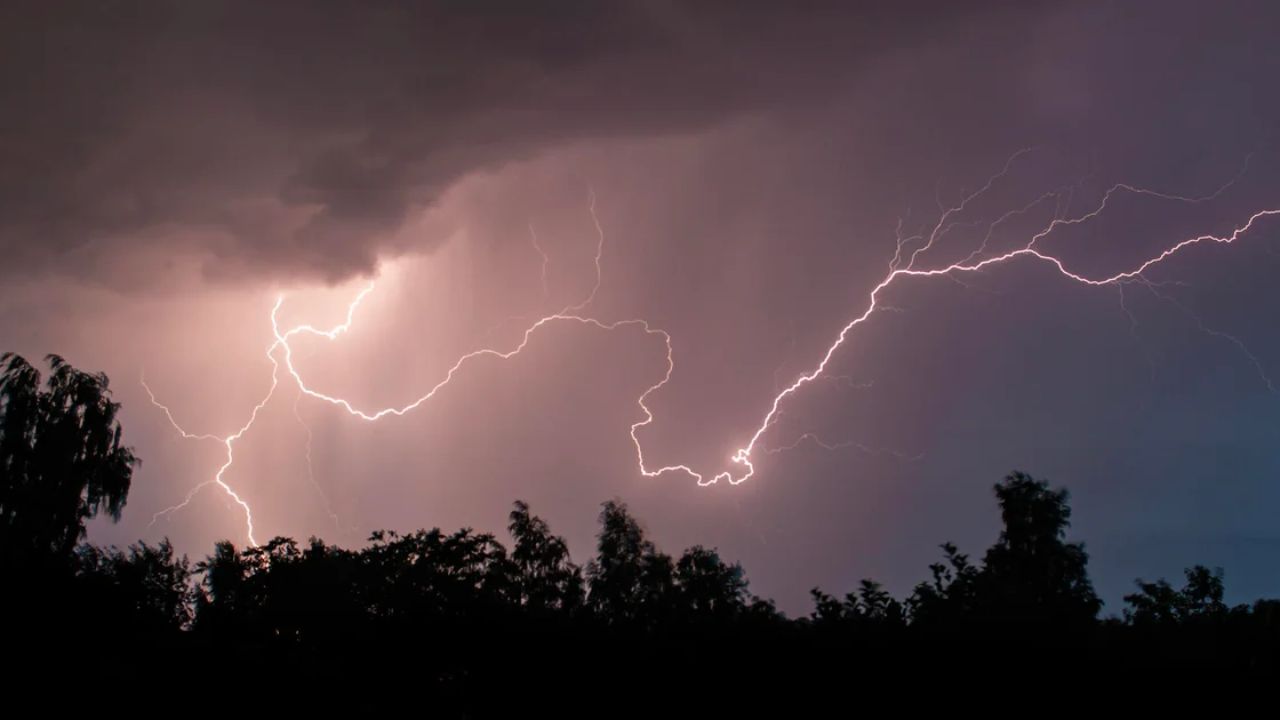
Overnight: The most dangerous window
This is the part that matters most.
The greatest severe weather risk arrives between 3 and 6 a.m., primarily south of Interstate 80, according to Storm Team Meteorologist Kevin Jeanes.
The Storm Prediction Center has placed Chicago’s southwestern counties under a “slight” risk — level two out of five. The rest of the metro area falls under a “marginal” risk at level one.
The primary threats overnight include:
- Hail up to one inch in diameter
- Damaging wind gusts potentially reaching 60 miles per hour
- Torrential rainfall with pockets of localized flooding
The tornado risk remains low, Jeanes said. But the wind and hail threat is real, and the overnight timing makes it especially dangerous since most people will not be awake to see it coming.
Set a weather alert on your phone before you sleep tonight.
Saturday: Mostly dry with a small storm chance
Overnight storms should push out of the area by 6 or 7 a.m. Saturday, according to Storm Team Meteorologist Iisha Scott.
After that, the day looks largely dry. Rain and storm chances sit around 30%, and while an isolated shower or thunderstorm cannot be ruled out in the afternoon, most of Saturday should be clear.
Highs are expected to reach the mid-80s — warm, but manageable.
Sunday and beyond: Heat is building
Sunday starts mainly dry across most of the Chicago area. Communities to the south and southwest carry slightly higher rain chances, but the majority of the region should stay dry throughout the day.
Temperatures dip slightly Sunday, with highs in the low 80s.
Then the heat arrives. Readings in the 90s are expected to return next week, bringing full summer conditions back to the area.
What you should do right now
Do not wait until the storm is already outside your window. Here are a few steps worth taking tonight:
- Enable wireless emergency alerts on your phone
- Charge your devices before going to bed
- Bring in any outdoor furniture, trash cans, or items that could become projectiles in 60 mph winds
- Know where you will shelter if conditions quickly worsen overnight
The overnight timing of this threat is what makes it unusual. Most people will be asleep during the 3 to 6 a.m. window. Having alerts set up in advance could make a real difference.
Are you prepared for tonight’s storms, or do you have concerns about your neighborhood? Share them in the comments below — your neighbors may need the heads-up too.