Austin, TX – A dangerous weather situation is unfolding across Central Texas today, with flash flooding already reported in parts of the region and more heavy rain expected through the evening. Areas from Austin down to San Antonio are under increasing risk as storms continue to move through.
According to the National Weather Service and its Weather Prediction Center, a “slight risk” of excessive rainfall remains in effect for Monday, April 20. This risk zone stretches along the busy Interstate 35 corridor, impacting major population centers and surrounding communities.
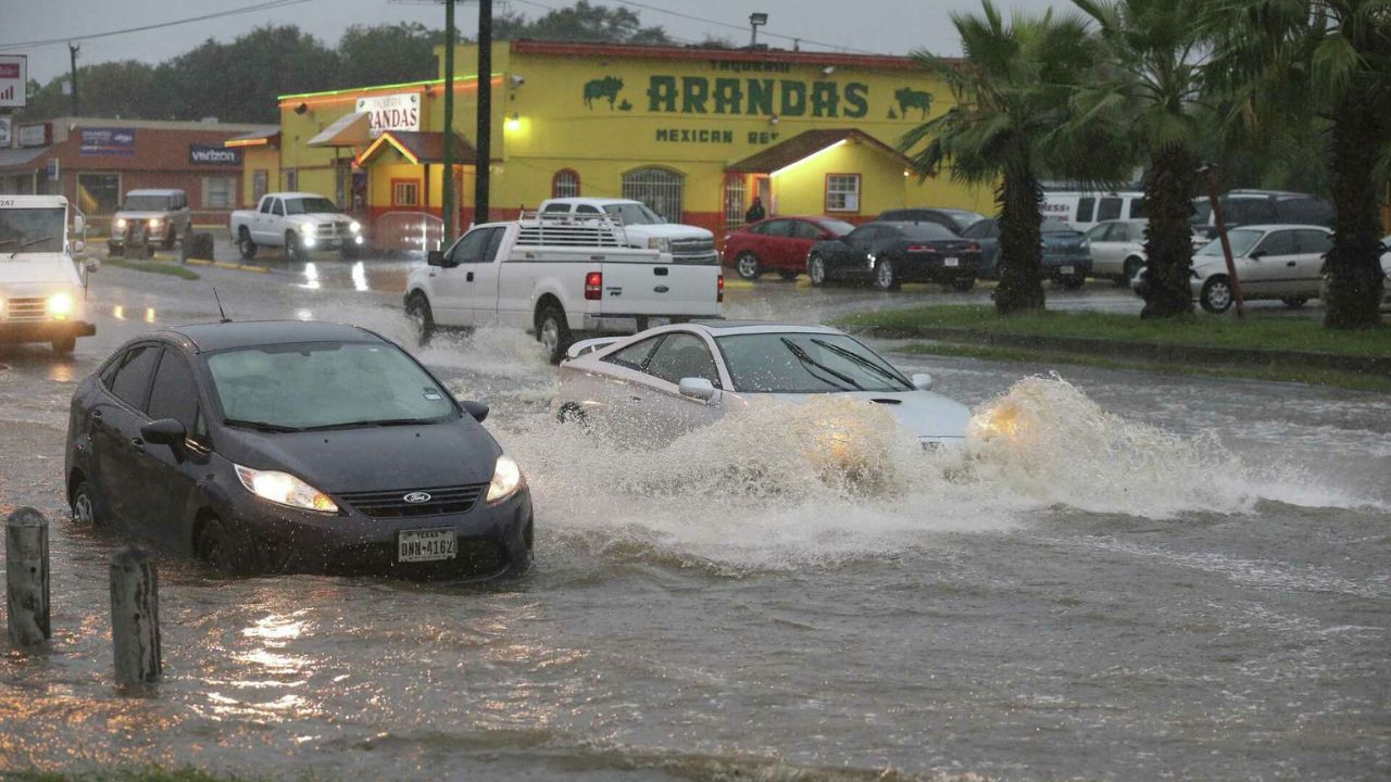
What’s Happening Right Now
Emergency officials say flash flooding has already begun in some locations this afternoon. Roads in low-lying areas are seeing water accumulation, and visibility has dropped in heavier downpours. Conditions are expected to worsen as additional rain bands develop and move across the region.
Forecasters estimate another 1 to 2 inches of rainfall, with isolated areas receiving even higher totals. These bursts of intense rain in short periods are what make flash flooding especially dangerous and unpredictable.
Why the Situation Is Serious
The biggest concern is how quickly water levels can rise. In urban areas like Austin and San Antonio, drainage systems can become overwhelmed, leading to rapid flooding on streets and highways.
Travel conditions are already becoming hazardous, especially along I-35, where drivers may encounter water-covered roads with little warning. Even a small amount of moving water can be enough to stall a vehicle or sweep it away.
Officials continue to stress the life-saving message: “Turn Around, Don’t Drown.”
What Residents Should Do
Authorities are urging people across Central Texas to stay alert and take precautions as conditions evolve:
- Avoid driving through flooded roads, even if water appears shallow
- Allow extra travel time or delay non-essential trips
- Keep emergency alerts enabled on your phone
- Monitor local weather updates closely throughout the evening
What Comes Next
The threat of flash flooding is expected to continue into the overnight hours, depending on how storm systems develop. Officials say the situation remains active and could change quickly.
Residents are encouraged to stay weather-aware and prepared, as additional advisories or warnings may be issued if conditions intensify.