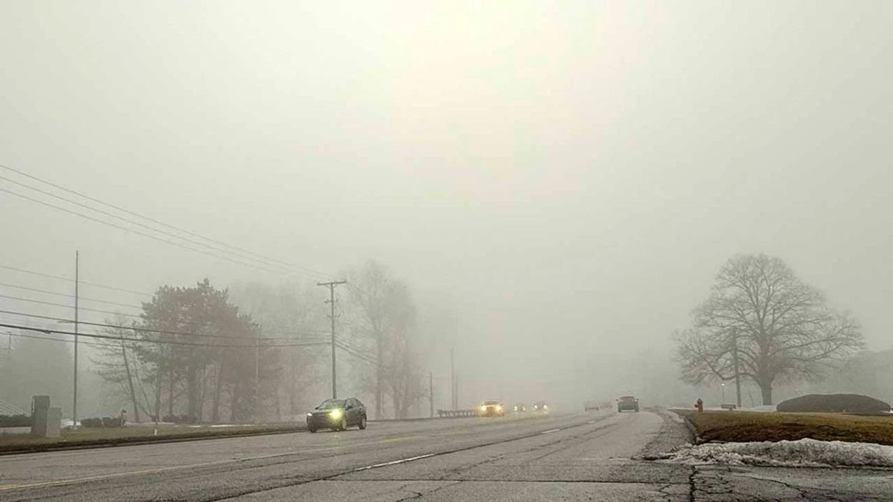
Pennsylvania – Pennsylvania is waking up to a dense, hazy start as thick fog settles across Pittsburgh, reducing visibility and making early travel slower than usual. Headlights glow softly through the mist, and in some areas, visibility has dropped to under two miles. The air feels heavy, and road surfaces remain slightly damp, especially near river valleys and low-lying areas.
Conditions are expected to change quickly as the day progresses. The morning fog will gradually lift, but the calm won’t last long. As temperatures rise rapidly toward the low 80s, the atmosphere becomes unstable—setting the stage for scattered showers and thunderstorms by mid to late afternoon.
Across Allegheny County, drivers are already experiencing reduced visibility along major routes like I-376, I-79, and Route 28. Sudden patches of thicker fog can appear without warning, so extra caution is advised. Keeping headlights on and maintaining safe distance between vehicles will be key during the morning commute.
By afternoon, the weather shifts from quiet to potentially disruptive. Thunderstorms may develop quickly, bringing bursts of heavy rain, gusty winds, and lightning. These storms could create brief but intense travel delays, especially during the evening rush hours. Conditions may worsen further after sunset as storm coverage increases.
The unsettled pattern continues into Friday. While the day may start with scattered showers, more storms are expected later, with temperatures again pushing close to 80°F. Wet roads and periodic delays are likely to persist.
Saturday begins on a warm note, with temperatures climbing into the low 80s. However, rain chances increase significantly by evening, leading to widespread showers overnight. This sets the stage for a noticeable shift heading into Easter Sunday.
By Sunday, cooler air moves in, dropping temperatures sharply into the mid-50s. Skies will remain mostly cloudy, creating a completely different feel compared to the warmth earlier in the week.
Early next week brings some relief, with calmer and cooler conditions. Sunshine gradually returns Monday and Tuesday, though temperatures stay on the cooler side, hovering in the 50s.
If you’re planning travel or outdoor activities, expect rapid changes—today’s fog and storms will give way to a much cooler and calmer pattern just in time for the new week.