Midwest, Plains, Northeast — A widespread and dangerous stretch of severe weather is unfolding across large parts of the United States this week, with tornadoes, damaging winds, hail, and heavy rainfall threatening communities from the Plains to the Midwest and into the Northeast. The multi-day system, which began earlier this week, is expected to continue through Saturday, bringing repeated rounds of storms and increasing the risk of flooding in already saturated areas.
What’s Happening Right Now
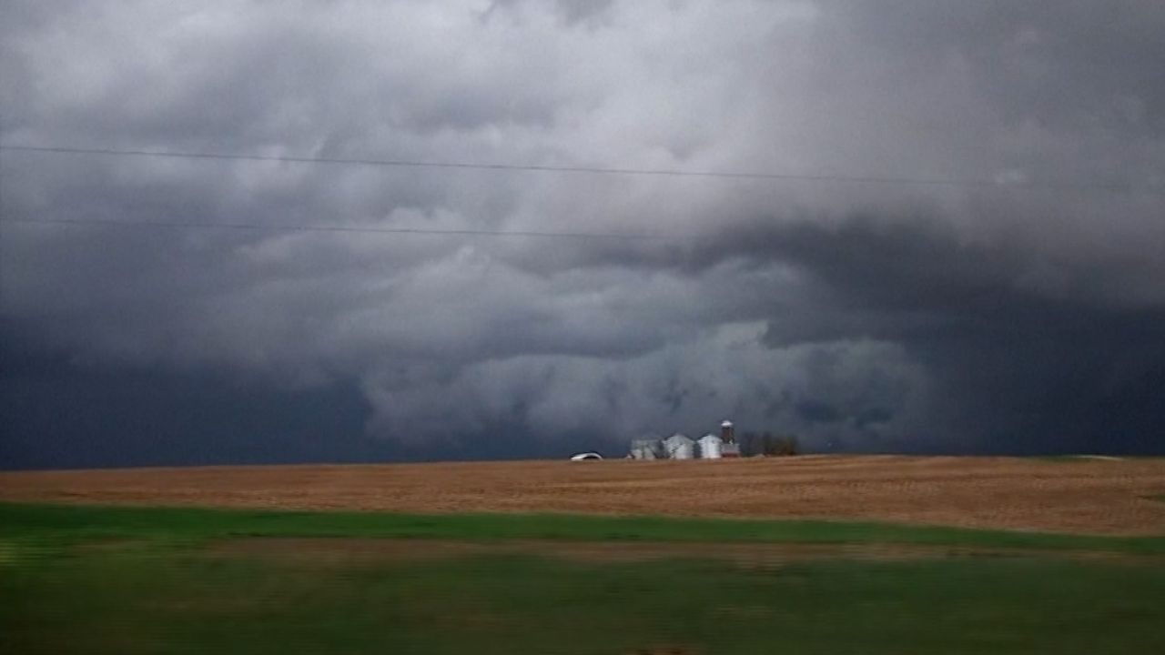
Severe thunderstorms are actively moving across the Plains and into the southern Great Lakes region. These storms are producing damaging wind gusts, large hail, and isolated tornadoes, along with bursts of heavy rain that could quickly overwhelm drainage systems.
Emergency officials warn that conditions can change rapidly, especially in areas where multiple storm cells pass over the same location within a short period of time.
Thursday Forecast: Isolated but Still Dangerous
Storm activity on Thursday is expected to be more scattered compared to earlier in the week, but that does not mean the threat is gone. The highest risk zone stretches from parts of the interior Northeast, including upstate New York, into central New England.
Residents in these regions could still see isolated tornadoes, strong winds, and hail. Even a single storm in these conditions can cause localized damage.
Friday: Highest Risk Day of the Week
Friday is shaping up to be the most dangerous period in this ongoing weather pattern. Meteorologists are closely watching a large zone from the Southern Plains through the Corn Belt, where atmospheric conditions are expected to support powerful storm development.
Both discrete supercell storms — which are capable of producing strong tornadoes — and organized lines of thunderstorms are likely. These systems could bring widespread damaging winds, embedded tornadoes, and intense rainfall during the afternoon and nighttime hours.
Communities in this zone are being urged to stay alert and prepared for rapidly changing conditions.
Saturday: Gradual Decline, But Threat Remains
By Saturday, the severe weather threat is expected to shift eastward and weaken slightly. Storms may still develop from the Great Lakes down through the Ohio Valley and into parts of Texas, but they are not expected to be as widespread or intense as Friday’s system.
A cold front moving across the country is expected to bring some relief by Sunday, potentially ending this active weather pattern for at least a couple of days.
Flooding Concerns Growing
Flooding is becoming a major concern, particularly in parts of the western Great Lakes. Rivers in states like Michigan and Wisconsin are already running high, with some forecast to reach or exceed major flood stage.
Additional rainfall — potentially exceeding one inch in many areas — is expected through Saturday. Cities including Kansas City, Chicago, Detroit, Cleveland, and Buffalo could see repeated rounds of rain.
In areas where the ground is already saturated, even moderate rainfall could trigger flash flooding. Urban areas and low-lying regions are especially vulnerable, and drivers are urged to avoid water-covered roads.
Why This Severe Weather Pattern Is So Persistent
The current weather setup is being driven by a combination of atmospheric factors. A strong high-pressure system over the eastern U.S. is pulling warm, moisture-rich air from the Gulf of Mexico northward into the Plains and Midwest.
At the same time, disturbances in the jet stream are moving in from the পশ্চিম U.S., creating instability in the atmosphere. This combination of moisture and instability is fueling repeated storm development over the same regions.
Because these systems are moving in waves, some areas are experiencing multiple rounds of severe weather over consecutive days.
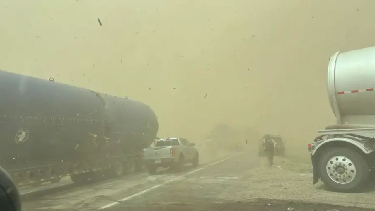
Recent Damage and Storm Reports
Since the beginning of this outbreak earlier in the week, hundreds of severe weather reports have been recorded. Tornadoes have been confirmed across several states, including Kansas, Wisconsin, and Oklahoma.
In some areas, tornadoes have caused structural damage to homes and buildings, while strong winds have torn off roofs and downed power lines, leaving thousands without electricity.
Large hail — in some cases as big as baseballs — has also been reported, damaging vehicles and property. Meanwhile, heavy rainfall has led to flash flooding, stranding vehicles and washing out roads in parts of the Midwest.
What Residents Should Do
With severe weather continuing through the end of the week, officials are urging residents in affected areas to remain vigilant. Having multiple ways to receive weather alerts, identifying safe shelter locations, and avoiding unnecessary travel during storms can make a critical difference.
This is a developing situation, and conditions may change quickly as new storms form and move across the country.