Another round of dangerous storms is set to impact parts of the Midwest on Thursday, bringing the potential for large hail, damaging winds and a few tornadoes. This marks yet another severe weather episode in what has already been an unusually active March across the region.
Forecasters say unseasonably warm air surging east from the Plains will provide the fuel needed for thunderstorms to intensify. Temperatures running well above late-March averages are creating an unstable atmosphere, increasing the likelihood of strong to severe storms by late afternoon and evening.
Thursday’s Severe Weather Outlook
Unlike typical spring setups where storms fire up early, this system may develop later in the day. Scattered thunderstorms are expected to form by late Thursday afternoon or early evening, especially across northern portions of Illinois and nearby areas.
Parts of the Chicago metro area could see storms during the evening hours. If development is delayed, some locations may stay dry into the late afternoon before activity ramps up rapidly toward sunset.
As the evening progresses, clusters of storms are expected to shift southward through:
- Illinois
- Indiana
- Ohio
- Western Pennsylvania
The strongest storms are most likely within a couple of hours around sunset, when atmospheric energy peaks and wind patterns become more favorable for severe weather.
A cold front stretching from central Illinois toward northwest Ohio will act as the primary trigger. Storms forming north of the boundary will mainly pose a threat for large hail and heavy rainfall. Areas along and south of the front face a greater tornado risk, particularly if isolated supercell thunderstorms can develop before merging into larger clusters.
There is also some uncertainty regarding additional development farther west into parts of Missouri, though that risk appears lower at this time.
By late night, a broken line of storms is expected to push southward, gradually weakening but still capable of producing gusty winds and heavy rain in spots.
Primary Threats
Residents in the impacted region should be prepared for multiple hazards:
- Large hail, potentially as large as baseballs in the strongest storms
- Damaging wind gusts strong enough to cause tree damage and scattered power outages
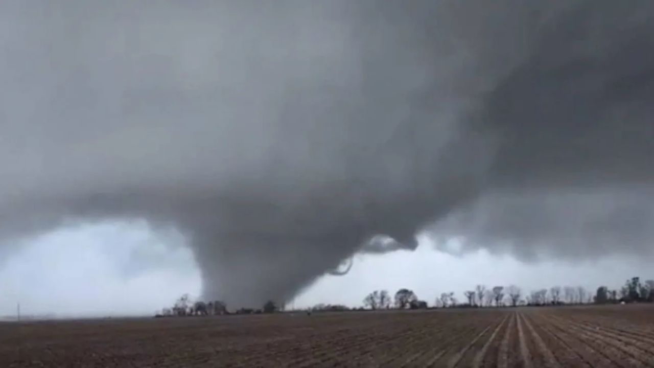
- A few tornadoes, possibly reaching EF2 intensity
- Localized flash flooding, especially in areas that receive repeated downpours
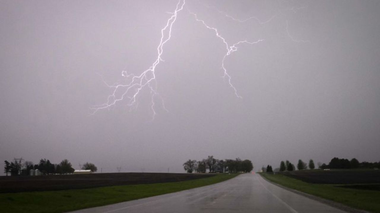
Even storms that do not produce tornadoes could still become dangerous quickly due to intense lightning and sudden wind bursts.
Staying Safe During Severe Weather
With repeated rounds of storms this month, preparation is critical. Here are three key steps to keep in mind:
- Identify your safe shelter ahead of time. The safest place during a tornado warning is a basement or an interior room on the lowest floor of a sturdy building, away from windows. Those living in manufactured or mobile homes should plan to relocate to a stronger structure or designated shelter well before storms arrive.
- Have multiple ways to receive warnings. Ensure emergency alerts are enabled on your phone. Keep devices fully charged and consider using a weather radio that can wake you overnight if warnings are issued.
- Take warnings seriously. When a severe thunderstorm or tornado warning is issued for your location, move to shelter immediately. Do not wait to visually confirm the threat.
Severe Weather Fatigue Setting In
This latest threat comes after several significant severe weather outbreaks earlier this month. Multiple tornado events have already struck parts of Illinois, Indiana and Michigan, causing fatalities and structural damage. Several EF2 and EF3 tornadoes have been confirmed in recent weeks, along with repeated episodes of large hail and destructive straight-line winds.
The pattern has been relentless, with storm systems arriving every few days. Warmer-than-normal temperatures across the central U.S. have repeatedly collided with cooler air masses, creating the perfect setup for rotating thunderstorms.
As March continues, forecasters warn that the atmosphere remains primed for additional severe weather episodes. Residents across the Midwest are urged not to let their guard down, especially as peak tornado season approaches in April and May.
The coming days will be critical in determining how intense Thursday’s storms become. Staying informed and prepared could make all the difference if warnings are issued in your area.