
- Strong to severe thunderstorms are moving into Miami-Dade, Broward, and Palm Beach counties today.
- A Level 1 marginal risk for severe weather is in place, with damaging winds, hail, and an isolated tornado possible.
- Some areas could see up to 3 to 5 inches of rain, raising the risk of localized flooding.
- Conditions could turn dangerous during the afternoon commute — residents should stay alert.
MIAMI, Florida — If you are planning to be outside this afternoon, you need to see this first.
Strong to potentially severe thunderstorms are rolling into South Florida today, Tuesday, May 12, as a frontal boundary pushes into the region. Heavy rain, gusty winds, and a real flood risk are all on the table — and things could move fast.
The National Weather Service in Miami says storms will start firing up this afternoon and continue into the early evening, stretching across the east coast metro.
Miami-Dade, Broward, and Palm Beach counties are all in the target zone.
A Severe Weather Risk Is Already in Place
Forecasters have placed South Florida under a Level 1 marginal risk for severe weather — the first step on a five-level scale — meaning a handful of storms could turn strong or severe.
The biggest threat is damaging wind gusts.
But the National Weather Service is not stopping there. Large hail and even an isolated tornado cannot be ruled out as these storms develop through the afternoon.
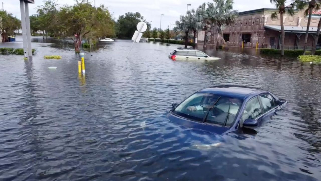
Flooding Is the Other Major Concern
Beyond the wind threat, excessive rainfall is a serious worry today.
Most of South Florida can expect between 0.5 and 1.5 inches of rain. But isolated areas could get hit with 3 to 5 inches in a short window — the kind of rainfall that overwhelms drains and turns streets into rivers quickly.
Low-lying neighborhoods and areas with poor drainage are at the highest risk.
If your street floods easily, do not wait for the water to rise before you act.
Your Afternoon Commute Could Get Dangerous
The timing of these storms lines up almost exactly with the late afternoon rush hour.
Gusty winds and sudden heavy downpours can slash visibility in seconds and make roads extremely hazardous. Drivers should leave extra time, avoid flooded roadways, and never attempt to drive through standing water.
Turn around, don’t drown — it only takes six inches of moving water to knock a person off their feet, and two feet to float most vehicles.
What You Should Do Right Now
Do not wait for the rain to start before you prepare. Here is what residents should do today:
- Download a weather alert app or enable emergency alerts on your phone
- Move vehicles away from low-lying areas or flood-prone streets
- Charge your devices before storms arrive
- Stay indoors during the peak storm window — mid-afternoon through early evening
- Check on elderly neighbors or family members who may not have received alerts
Stay Connected to Official Updates
Conditions can change rapidly with this type of storm setup. The National Weather Service in Miami will be issuing updated alerts throughout the day.
Residents are strongly encouraged to monitor local alerts in real time and not rely on forecasts made hours earlier — especially as storms approach your specific area.
South Florida weather can be unpredictable, but being prepared is always in your control.
Are you seeing storms or flooding in your neighborhood today? Drop your location in the comments and let your community know what conditions look like on the ground.


