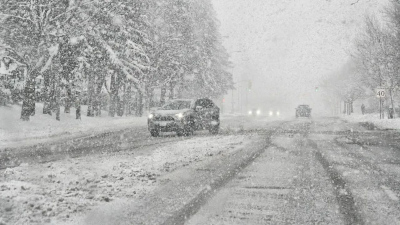
Plymouth, Indiana – Drivers across northern Indiana and parts of southwest Michigan are being urged to prepare for hazardous travel conditions as lake effect snow intensifies beginning early Wednesday and continues into Thursday afternoon. Forecasters warn that periods of heavy snow, strong winds, and sharply reduced visibility could make commuting difficult, especially during peak travel hours.
According to the National Weather Service, a Winter Weather Advisory has been issued for parts of northern Indiana and southwest Michigan, with accumulating snow and blowing conditions expected to create dangerous roadways.
Incident Overview
The winter weather system is being driven by cold air moving across the relatively warm waters of Lake Michigan, creating lake effect snow bands that can stall over specific communities. These bands are expected to produce 3 to 6 inches of snow in portions of northern Indiana, with some areas in southwest Michigan potentially seeing even higher localized totals.
The advisory remains in effect from early Wednesday morning through Thursday afternoon, covering Marshall County and Starke County in Indiana, as well as Cass County in Michigan.
Timeline of Expected Conditions
Snow showers are forecast to begin increasing in intensity early Wednesday, with conditions deteriorating through the day. The most significant impacts are expected during the Wednesday evening commute, when snowfall rates may increase and visibility drops rapidly.
Overnight into Thursday morning, persistent lake effect bands could continue to deposit snow in the same areas, leading to uneven but potentially significant accumulations. Snow is expected to gradually taper by Thursday afternoon, though slick roads may remain even after snowfall eases.
Details From Weather Officials
Meteorologists say northwest winds gusting up to 35 mph will play a major role in worsening travel conditions. These gusts can cause blowing and drifting snow, making it difficult for road crews to keep up with rapidly changing conditions.
“Lake effect snow can produce very sharp gradients, meaning one area may see heavy snowfall while nearby locations remain mostly dry,” forecasters noted. “Drivers should be prepared for sudden whiteout conditions.”
Officials emphasize that conditions may change quickly over short distances, catching drivers off guard.
Key Facts at a Glance
- Snow totals: 3–6 inches possible
- Heaviest impact areas: Marshall County, IN; Starke County, IN; western Cass County, MI
- Wind gusts: Up to 35 mph
- Visibility: May drop to one-quarter mile or less during heavier snow bands
- Timeframe: Wednesday morning through Thursday afternoon
Communities Most Likely to Be Affected
In Indiana, cities including Plymouth, Knox, North Judson, and Culver may experience periods of intense snowfall. In Michigan, areas near Cassopolis and Dowagiac are also within the advisory zone.
Because lake effect snow bands can remain stationary for hours, some neighborhoods could receive significantly more snow than others just a few miles away.
Travel and Safety Concerns
Transportation officials warn that bridges and overpasses are likely to become slick first, increasing the risk of spin-outs and collisions. Reduced visibility combined with blowing snow can make it difficult to see lane markings, stalled vehicles, or plow trucks.
Drivers are advised to slow down, leave extra following distance, and ensure vehicles are equipped for winter travel. Checking local road conditions before heading out is strongly recommended, particularly for those traveling during the evening or early morning hours.
Why Lake Effect Snow Is Especially Dangerous
Unlike widespread winter storms, lake effect snow is highly localized and unpredictable. A clear roadway can suddenly turn treacherous within minutes when a snow band moves overhead. This variability increases the risk of accidents, especially for drivers unfamiliar with rapidly changing winter conditions.
Conclusion
Lake effect snow is expected to bring challenging travel conditions to northern Indiana and nearby Michigan through Thursday afternoon, with up to 6 inches of snow possible in the hardest-hit areas. Strong winds, blowing snow, and reduced visibility will contribute to hazardous driving conditions, even after snowfall begins to taper.
Motorists are encouraged to stay weather-aware, adjust travel plans if possible, and use extra caution on area roads. If you’re in the affected region, share how the weather is impacting your area and share your experiences in the comments below.