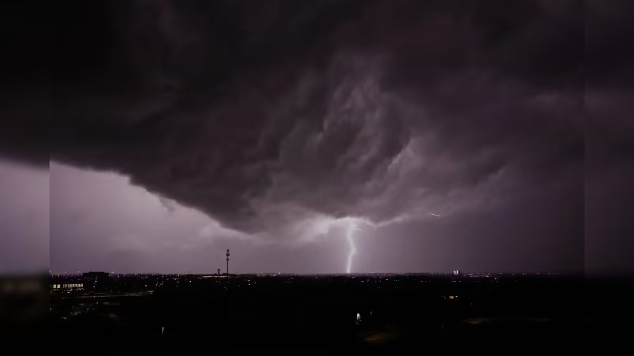
North Texas: Severe weather swept across parts of the region Friday evening, bringing tornado warnings, large hail, and damaging winds, with officials warning that storm risks could continue through the weekend.
The situation intensified late Friday as multiple warnings were issued across counties including Hopkins, Delta, Lamar, and Hunt. Around 8:27 p.m., a tornado warning was first issued for northeastern Hopkins, northeastern Delta, and southeastern Lamar counties. The warning remained active through the evening, with updates issued as storms rapidly developed and moved east.
By 8:46 p.m., severe thunderstorms in northeastern Delta and southern Lamar counties were already producing dangerous conditions, including tennis-ball-sized hail and wind gusts reaching up to 60 mph. Shortly after, at 8:53 p.m., another tornado warning was issued, lasting until 9:30 p.m., signaling a heightened threat in the same region.
At 9:06 p.m., a separate severe thunderstorm warning was issued for northeastern Hunt, central Hopkins, Delta, and southern Lamar counties, continuing until 10 p.m. However, by 9:15 p.m., earlier tornado warnings began to expire as storms shifted, though the risk remained active in surrounding areas.
Earlier in the evening, a broader tornado watch covered several counties, including Delta, Fannin, Hopkins, Hunt, Lamar, and Rains. This watch was later canceled for Collin, Cooke, Grayson, and Rockwall counties as storm activity shifted eastward.
Weather officials had anticipated storm development along the I-35 and I-20 corridors between 5 and 6 p.m., with the most severe activity expected near the Highway 271 corridor. That prediction proved accurate, as storm intensity peaked around sunset, between 8 and 9 p.m.
The primary concerns throughout the evening included large hail, strong wind gusts, and heavy rainfall capable of causing localized flooding. Residents in affected areas were urged to stay alert, monitor weather updates closely, and be ready to seek shelter at a moment’s notice.
The day had started relatively calm, with breezy and mild conditions and temperatures in the 70s. However, atmospheric changes, including a boundary pushing south toward the Dallas-Fort Worth area, helped weaken a protective cap in the atmosphere, allowing storms to develop. This created the potential not only for hail and wind damage but also a low, yet real, tornado threat.
Looking ahead, forecasters warn that the unsettled weather pattern is not over. There remains a 20% to 30% chance of storms across North Texas through the weekend. While not every area will see rain, any storm that does form could quickly become severe.
Saturday is expected to bring the highest chance for storms entering the Dallas-Fort Worth metro area, particularly during the afternoon and early evening hours. Weather models continue to show consistent storm development during this time.
In addition to storm risks, temperatures are expected to climb into the upper 80s to near 90 degrees, with humid conditions adding to the discomfort. By Monday, temperatures could rise further into the 90s, offering a brief break from storm activity before rain chances return early next week.
Officials continue to emphasize preparedness, urging residents to have multiple ways to receive weather alerts and a clear plan in place in case conditions worsen suddenly.