RALEIGH, North Carolina — A stretch of your Wednesday evening just got a lot more complicated.
The National Weather Service in Raleigh is tracking scattered thunderstorms expected to push southeast into the northwestern and northern Piedmont between 4 p.m. and 9 p.m. this evening.
A few of those storms could turn strong — and the timing puts them right in the middle of the evening commute.
Who Needs to Pay Attention Tonight
The areas most likely to see the strongest activity include the Triad and Triangle corridors.
That means residents in Raleigh, Durham, Chapel Hill, Greensboro, Winston-Salem, and surrounding communities should stay alert through the early evening hours.
The Storm Prediction Center has placed portions of central North Carolina under a Level 1 marginal risk for severe weather — the lowest level on the severe weather scale, but still enough to produce hazardous conditions locally.
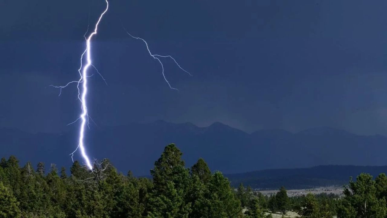
What the Storms Could Bring
The tornado and hail threats are considered low for this event.
The bigger concern tonight is damaging wind gusts.
Stronger cells could produce sudden bursts of wind powerful enough to knock down small branches, scatter unsecured outdoor items, and cause isolated power outages in spots.
Meteorologists note that while not every storm will reach severe levels, conditions are unstable enough that a few storms could strengthen quickly.
When the Worst Is Expected
The window of greatest concern runs from roughly 4 p.m. through 9 p.m.
Activity is expected to gradually weaken later tonight as the storms continue moving southeastward out of the region.
If you have outdoor plans for this evening — a game, a cookout, a workout outside — keep a close eye on the radar and be ready to head inside quickly if storms approach.
What You Should Do Right Now
Residents across the affected area are encouraged to take a few simple steps before the storms arrive.
Bring in or secure any loose outdoor furniture, decorations, or equipment that wind could pick up or damage.
Make sure you have a reliable way to receive weather warnings — a weather app with push alerts, a NOAA weather radio, or notifications turned on from the National Weather Service.
If you are driving during the 4 p.m. to 9 p.m. window, check conditions before heading out and pull over safely if heavy rain or strong winds reduce visibility.
Storms are forecast to weaken and move out of the area by late evening, so tonight should calm down considerably after 9 p.m.
Are you in one of the affected areas tonight? Let us know in the comments how the weather looks from where you are — your real-time updates help your neighbors stay informed.