KANSAS CITY, Missouri — A violent storm outbreak tore through the central United States Monday, bringing tornadoes, egg-sized hail, winds up to 75 mph and flash flooding — and the system is not finished yet.
The storms are now pushing east, and millions of people from northern Texas to Michigan are still in the path.
What Happened Monday
Supercell thunderstorms fired up across Kansas and Nebraska Monday afternoon, producing multiple tornadoes and golf ball-to-egg-sized hail before merging into a single fast-moving line of storms by evening.
In Richardson County, Nebraska, a classic stovepipe tornado carved through farmland, damaging several farmsteads. Emergency Management Director Brian Kirkendall confirmed no injuries were reported.
The National Weather Service issued a rare tornado emergency for southeastern Nebraska after a tornado was confirmed in Pawnee County. No damage was reported there.
By Monday evening, the biggest threat shifted from tornadoes to damaging straight-line winds — with gusts reaching 75 mph — as the storms pushed toward the Lower Missouri Valley.
Flash flooding also broke out across parts of Kansas and Nebraska, with Kansas City facing a Level 3 of 4 flood risk from torrential rainfall.
How Rare Is This Storm System
The Storm Prediction Center issued a Level 4 of 5 severe thunderstorm risk — a designation used on only about 14 days per year nationwide.
That alone tells you how significant this outbreak is.
The setup was fueled by a powerful surge of jet stream energy colliding with deep moisture across the Plains — a combination that meteorologists describe as nearly ideal for violent storm development.
Tornadoes Already Destroyed Homes This Weekend
Before Monday’s storms even arrived, the outbreak had already left a trail of damage across Nebraska.
On Sunday, a tornado struck the town of St. Libory in Howard County, north of Grand Island. Multiple structures collapsed. Video from the scene showed two people and a dog being pulled from the rubble of a destroyed home.
No one was killed. The tornado was rated an EF3 with peak winds of 160 mph, according to the National Weather Service.
A tornado emergency — the most serious type of tornado warning — was also issued Sunday near Hebron, Nebraska. These warnings are only issued when forecasters are certain a large, damaging tornado is on the ground.
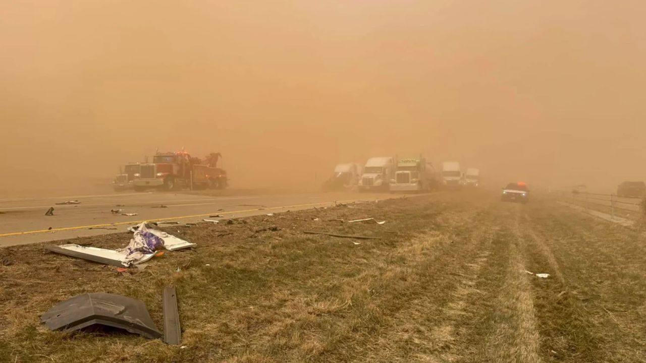
Wildfires Are Burning at the Same Time
The same weather system is driving a separate, equally dangerous crisis to the south and west.
The National Weather Service has issued a Level 3 of 3 extremely critical fire danger rating across the southern High Plains, where winds of 25 to 30 mph, gusts up to 50 mph and humidity levels below 10 percent are pushing wildfires to spread at a life-threatening pace.
Over 100,000 acres have already burned across southwest Kansas alone. The Meade County Complex 1 fire has grown to more than 92,000 acres and is zero percent contained.
The Sharpe Fire has crossed the Oklahoma-Colorado state line and burned more than 44,000 acres. A mandatory evacuation was ordered for the town of Campo, Colorado, before firefighters established a containment line around it. No occupied homes have been lost.
In the Texas Panhandle, multiple fires are burning. The Hunggate and Chocolate Chip fires in Randall County have scorched more than 55,500 acres combined. A BNSF railroad trestle was lost in the Hunggate fire.
State disaster emergencies have been declared in both Colorado and Kansas.
What Tuesday Looks Like
The severe storm threat eases Tuesday but does not disappear.
A Level 2 of 5 risk for severe thunderstorms stretches from northern Texas all the way to Michigan. Damaging winds and large hail are the primary threats, both from storms carrying over from Monday night and new storms expected to develop during the afternoon.
If you are in the path of this system Tuesday, stay weather-aware and keep alerts on your phone turned on.
What is the weather looking like in your area right now? Have you seen storm damage near you? Share what you are seeing in the comments below.