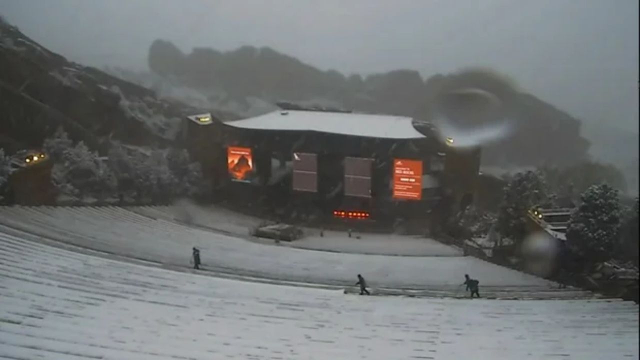
A powerful late-season storm swept the Front Range overnight, piling up to 6 inches of snow in Denver and more than 20 inches in mountain foothills — forcing school closures, grounding flights, and snarling highways.
Denver Spring Snowstorm news article with weather statistics and snow totals by location
WeatherWednesday, May 6, 2026
Heavy spring snowstorm buries Colorado as Denver schools close and roads turn dangerous
A powerful late-season storm swept the Front Range overnight, piling up to 6 inches of snow in Denver and more than 20 inches in mountain foothills — forcing school closures, grounding flights, and snarling highways.
Freeze warnings and watches remain in effect across many Colorado areas. Wednesday morning commute will be very slick statewide. Motorists urged to allow extra travel time.
What started as rain in the Denver metro area shifted to heavy snow Tuesday evening, catching commuters off guard across Colorado’s Front Range. Temperatures hovered at 34°F in Denver at 6 p.m., delaying road accumulation — but officials warned conditions would deteriorate sharply overnight as mercury dropped.
A jack-knifed semi-truck on Interstate 70 near Evergreen Parkway backed up traffic for hours during the evening rush, offering an early preview of the hazards ahead. Visibility also dropped significantly in areas including the Denver Tech Center and Castle Rock, where dense fog added to the driving challenge.
Denver Public Schools and Aurora Public Schools were among the first to announce Wednesday closures, with dozens of Front Range and northern Colorado districts following suit by mid-evening.
At Denver International Airport, departing aircraft required de-icing Tuesday night. Travelers are advised to check flight status before heading to the airport.
Before the snow began, Denver recorded over a quarter-inch of rain. Fort Collins saw nearly an inch of rain ahead of the snowfall. The Colorado Department of Transportation deployed roughly 100 snowplows in the Denver region, though officials acknowledged roads were not pre-treated due to warm temperatures leading up to the storm.
The heaviest accumulations are expected in Colorado’s northern and central mountains. Estes Park had already recorded 20 inches before dark on Tuesday, while Rabbit Ears Pass surpassed a foot of snow with more falling overnight. Mountain snowfall is expected to continue piling up through Wednesday afternoon.
Once the storm exits, freeze warnings and watches will go into effect across much of the state — meaning even areas that see little snow should brace for icy surfaces into Thursday morning