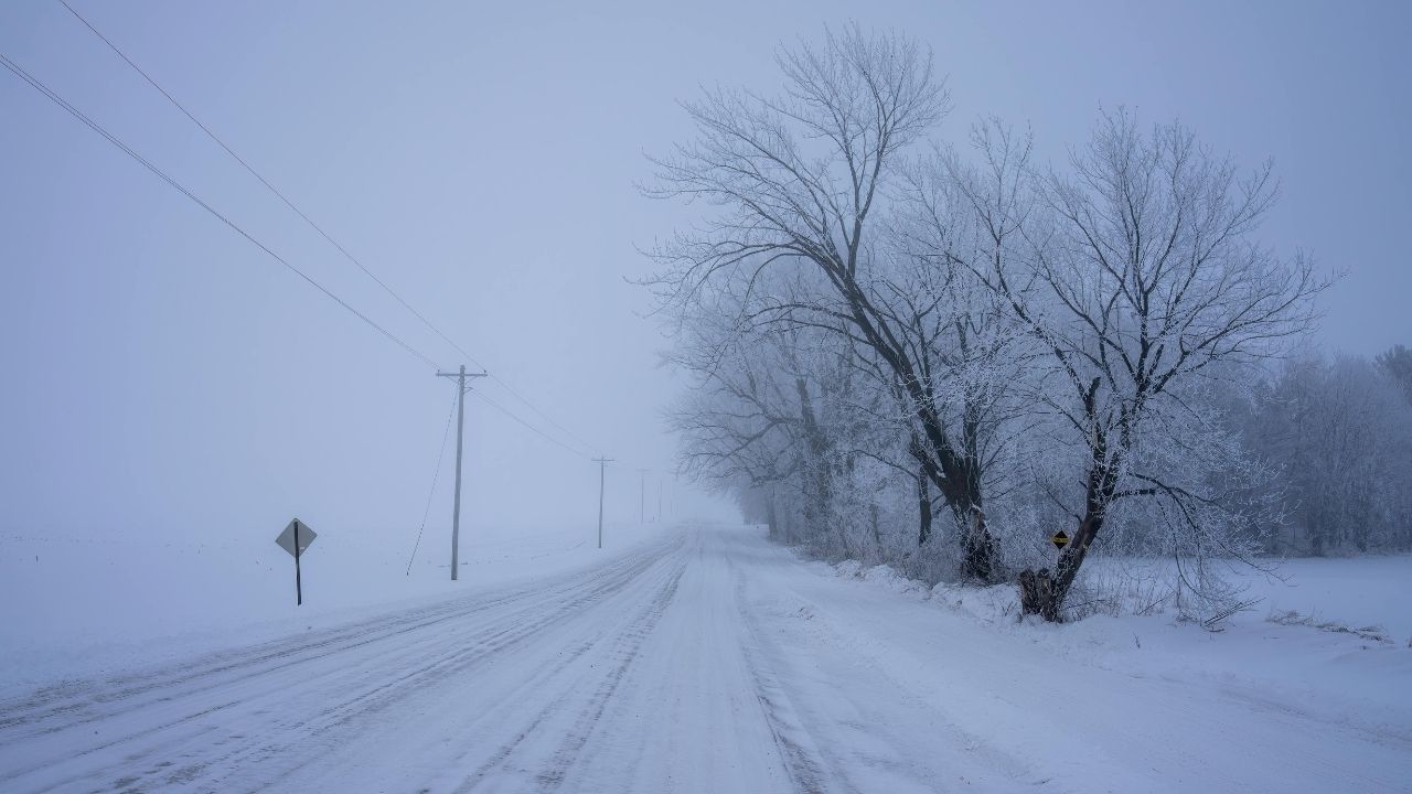
Mountain City, Tennessee – Snow is expected to move into northeast Tennessee late Wednesday, creating slick roads and hazardous travel conditions across higher elevations through Thursday morning. Forecasters warn that untreated roads, bridges, and mountain passes could quickly become dangerous as snowfall intensifies overnight.
Travel impacts are expected across portions of northeast Tennessee and southwest Virginia, where winter weather advisories remain in effect. Officials are urging drivers to prepare for reduced visibility, blowing snow, and difficult driving conditions during the Wednesday night and Thursday morning commute.
Incident Overview
A Winter Weather Advisory has been issued for parts of northeast Tennessee, including Johnson County, Unicoi County, and portions of Carter, Greene, and Monroe counties. The advisory is active from Wednesday afternoon through Thursday morning, as a system brings accumulating snow and gusty winds to the region.
Snowfall totals of 2 to 4 inches are expected across these counties, with locally higher amounts possible along the highest elevations. Wind gusts could reach up to 35 mph, creating areas of blowing snow and sharply reduced visibility on exposed roads.
Timeline of Events
Snow is expected to begin developing late Wednesday afternoon, with conditions worsening into the evening hours. By Wednesday night, road conditions are likely to deteriorate quickly, particularly across mountain communities and secondary roads.
The heaviest snowfall is forecast to occur overnight into early Thursday morning, coinciding with the morning commute. Snow is expected to taper off by late Thursday morning, though slick spots may persist into the afternoon.
Details From Weather Officials
According to the National Weather Service in Morristown, the combination of snow accumulation and gusty winds will increase travel hazards across the region. Forecasters emphasize that bridges, overpasses, and higher elevation roads will become slick first.
“Snow-covered roads and blowing snow may create hazardous travel conditions, especially in higher elevations and on untreated surfaces,” the National Weather Service stated in its advisory.
Additional details and updates are available through the National Weather Service forecast office in Morristown at the official National Weather Service website.
Areas Most Likely to Be Impacted
Several communities in northeast Tennessee are expected to see snow-covered roads by Wednesday evening, including Mountain City, Erwin, Hampton, Trade, Shady Valley, and Coker Creek. These areas frequently experience more intense winter impacts due to elevation and terrain.
In southwest Virginia, a Winter Weather Advisory is also in effect for Wise County and Russell County. Communities such as Wise, Norton, Big Stone Gap, Lebanon, and Castlewood are expected to receive 1 to 3 inches of snow, with similar impacts on untreated roads and elevated surfaces.
Key Facts at a Glance
• Advisory Period: Wednesday afternoon through Thursday morning
• Expected Snowfall (TN): 2–4 inches, locally higher at peaks
• Expected Snowfall (VA): 1–3 inches
• Wind Gusts: Up to 35 mph
• Most Hazardous Areas: Bridges, overpasses, mountain roads
• Primary Concern: Slick roads and reduced visibility
Safety and Travel Awareness
Transportation officials in both Tennessee and Virginia are advising drivers to slow down, increase following distances, and allow extra travel time. Motorists are also encouraged to avoid unnecessary travel during periods of heavier snowfall.
Checking road conditions before heading out is strongly recommended. Drivers can monitor real-time updates by dialing 511, which provides current roadway conditions, closures, and travel advisories for both states.
Winter weather experts also caution that shaded areas and higher elevations may remain icy even after snowfall ends, increasing the risk of accidents later in the day.
Additional Context on Winter Driving Risks
Even modest snow totals can create dangerous conditions in mountainous regions, where elevation changes, narrow roadways, and limited treatment access can worsen travel hazards. Blowing snow can quickly refreeze, forming black ice that is difficult for drivers to detect.
Authorities remind residents to keep emergency supplies in their vehicles, including blankets, water, flashlights, and fully charged phones, especially when traveling through rural or mountainous areas.
Conclusion
Snow and gusty winds are expected to make travel hazardous across northeast Tennessee and southwest Virginia through Thursday morning. While snowfall will taper off later in the day, slick roads and lingering icy spots may continue to pose risks, particularly in higher elevation areas.
Drivers are urged to stay weather-aware, plan ahead, and prioritize safety as winter conditions move through the region. Share your experiences in the comments below.