Dallas–Fort Worth, Texas – A period of unsettled weather is expected to impact North Texas starting Wednesday night, as scattered rain and isolated thunderstorms move through the region before a much cooler air mass arrives over the weekend.
Forecasters say the overall severe weather threat remains limited, but changing conditions could still bring brief impacts to travel and outdoor plans across the Dallas–Fort Worth Metroplex and surrounding areas.
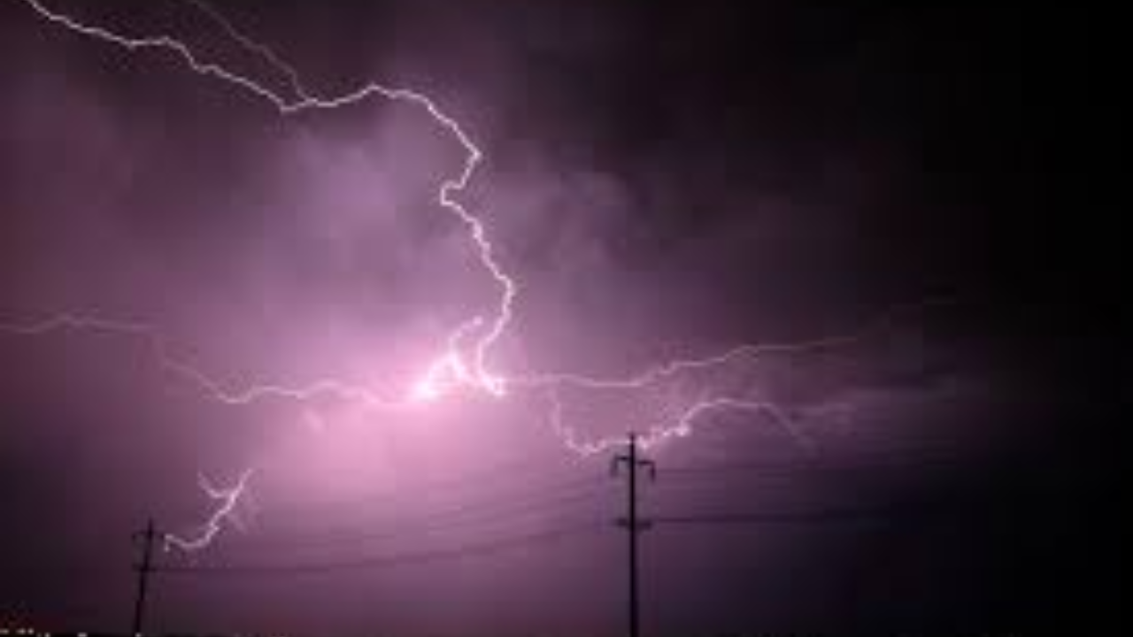
Midweek Rain and Storm Setup Across North Texas
According to the National Weather Service office in Fort Worth, showers and isolated thunderstorms are expected to develop late Wednesday night and continue intermittently through Friday. Atmospheric conditions will be favorable for periods of rain, though widespread severe storms are not anticipated.
The strongest activity is most likely to develop west of the Metroplex, where instability and lift will be slightly higher compared to areas farther east.
Areas With Higher Storm Potential
While much of North Texas will see scattered rain, western counties face the greatest chance of stronger storms. Locations including Graham, Cisco, and areas west of the I-35 corridor could experience:
- Small hail
- Gusty winds
- Brief heavy downpours
Across the immediate Dallas–Fort Worth area, storms are expected to remain mostly below severe limits, though lightning and localized heavy rain are still possible.
Rain Chances Through the End of the Week
Rain probabilities will vary across the region as multiple disturbances move through:
- Wednesday night: Rain chances around 20–30 percent in the DFW Metroplex
- North of DFW (Sherman, Paris): Increased chances of 40–60 percent
- Thursday: Scattered showers continue, with the highest coverage shifting east of DFW
- Friday: A cold front triggers another round of showers and storms, mainly across Central and East Texas, including Waco, Killeen, and Palestine
Western portions of North Texas are expected to see activity gradually decrease by Thursday as the system shifts eastward.
Travel and Daily Impact Outlook
Widespread disruptions are not expected, but brief heavy rainfall could lead to slick roads, especially during overnight and early morning commute hours. Ponding on roadways may occur in spots that experience repeated rounds of rain.
Drivers are encouraged to allow extra travel time during periods of heavier showers and remain alert for rapidly changing conditions, particularly late at night.
Cooler Air Arrives This Weekend
Behind Friday’s cold front, a significant temperature drop is forecast for North Texas. Much cooler air will settle into the region for the weekend and early next week.
Forecast highlights include:
- Daytime highs: Falling into the 50s
- Morning lows: Dropping into the 20s and 30s
- Increased potential for chilly mornings and colder overnight conditions
Residents may need to prepare for a return to winter-like temperatures after a relatively mild stretch earlier in the week.
Forecast Confidence and Updates
Meteorologists note that forecast details may continue to evolve, particularly regarding the exact timing of the cold front and the placement of heavier rain bands. Additional updates are expected as newer data becomes available.
Staying informed through official forecasts and local alerts will help residents plan for both the midweek rain chances and the colder weather that follows.
Conclusion
North Texas is set for a mixed weather pattern over the coming days, with scattered rain and isolated storms midweek giving way to a sharp cooldown by the weekend. While severe weather risks remain low, brief travel impacts and colder temperatures will be the main concerns.
Share your experiences in the comments below.