Salt Lake City, Utah – Drivers across the Wasatch Front should prepare for slick roads, reduced visibility, and slower travel late Wednesday through early Friday as a colder winter system delivers accumulating snow to valley locations and heavier snowfall in the mountains. The most significant impacts are expected during the Thursday morning commute, when snowfall rates could briefly intensify.
According to the National Weather Service in Salt Lake City, snow will begin developing across northern Utah Wednesday afternoon, spreading statewide by Wednesday night and continuing through at least early Friday morning. Forecasters say timing and intensity will be key factors for commuters and travelers, particularly along major corridors near the Wasatch Front.
Snow Timeline and Expected Impacts
Forecasters indicate that light snow will develop Wednesday afternoon, with coverage increasing through the evening and overnight hours. By early Thursday, a colder air mass moving through the region is expected to enhance snowfall rates, especially in northern Utah.
The Thursday morning commute is expected to be the most problematic window, as snow-covered roads and intermittent bursts of heavier snowfall could slow traffic and increase crash risk. Conditions may gradually improve later Thursday, though periodic snow showers could persist into Friday morning.
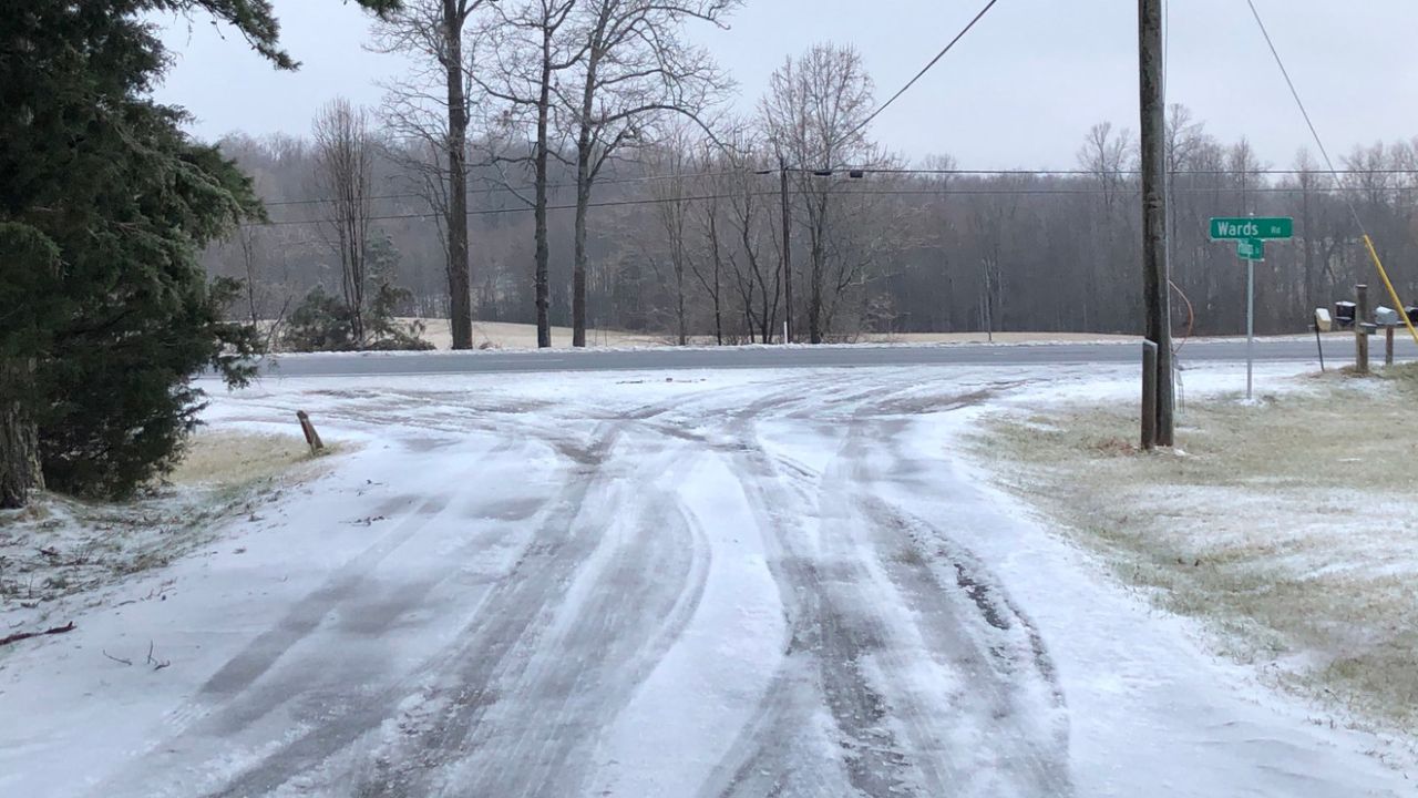
Valley Snowfall Forecast Along the Wasatch Front
Communities along the Wasatch Front, including Salt Lake City, Ogden, and Provo, are forecast to receive 1 to 4 inches of snow. Localized higher totals are possible along foothill benches, where colder air and upslope flow can enhance accumulation.
While these amounts are not extreme, even modest snowfall can create hazardous travel conditions during peak commute times. Untreated roads, bridges, and overpasses are especially susceptible to becoming slick as temperatures hover near or below freezing.
Mountain Snow and Pass Travel Concerns
Mountain impacts will be significantly greater than in the valleys. Northern Utah mountain ranges, including the Upper Cottonwoods and the Bear River Range, are expected to receive 6 to 12 inches of snow, with locally higher totals in favored terrain.
Central and southern Utah mountains may see 4 to 8 inches, which could lead to difficult travel over mountain passes and canyon routes. Drivers heading into higher elevations should be prepared for chain restrictions, reduced visibility, and snow-packed roads, particularly early Thursday.
Cold Front Brings Heavier Snow Thursday Morning
Meteorologists note that snowfall is expected to be heaviest along a passing cold front Thursday morning, especially in northern Utah. During this period, snowfall rates could briefly increase, lowering visibility and quickly coating roadways.
These short bursts of heavier snow are often responsible for rapidly deteriorating road conditions, catching drivers off guard during the busiest travel hours. Officials emphasize that even short trips could take longer than usual under these conditions.
Lake-Effect Snow Uncertainty Near Great Salt Lake
Adding complexity to the forecast is the potential for lake-effect snow, which may develop as cold air moves over the relatively warmer waters of the Great Salt Lake. If this setup materializes, localized snowfall totals could increase, particularly near the lake and into Tooele Valley from Thursday into Friday.
Lake-effect snow is notoriously difficult to predict in terms of exact placement, meaning some areas could see noticeably higher accumulations than nearby locations.
Safety Advice for Drivers and Commuters
The National Weather Service urges motorists to take extra precautions during this winter weather event. Key recommendations include:
- Slow down and increase following distance, especially on snow-covered roads
- Allow extra travel time for the Thursday morning commute
- Check road and weather conditions before departing
- Use caution on bridges, overpasses, and canyon routes where ice forms quickly
Additional advisories or warnings may be issued as snowfall intensity and placement become clearer through midweek.
What to Expect Going Into Friday
Snowfall is expected to gradually taper late Thursday into early Friday morning, though lingering snow showers could still impact travel in some areas. Temperatures will remain cold enough for snow to stick, particularly during overnight and early morning hours.
Drivers should continue monitoring updates from local officials and weather services, as even small shifts in storm track or lake-effect development can significantly change local conditions.
Conclusion
This midweek winter system is expected to bring accumulating snow, mountain travel hazards, and challenging commute conditions across northern Utah. While valley totals may remain moderate, timing during peak travel hours and heavier mountain snowfall could create notable impacts. Planning ahead and exercising caution will be essential for safe travel through early Friday.
Share your experiences in the comments below.